Tuesday, June 30, 2015

Fairbanks, AK

We drove about 95 miles from Delta Junction to Fairbanks on Saturday, June 27th. We  decided to go out for breakfast on Sunday morning at Sam’s Sourdough CafĂ©. After breakfast, we headed to the nearby University of Alaska Fairbanks Museum of the North. We thoroughly enjoyed the museum.


On Sunday we invited friends of Julie’s sister Cindy over for a Steve-o-Rita. Larry and Cindy had been fishing for halibut and salmon in Homer which we were very interested to hear about. We enjoyed meeting them and sharing Alaska travel tips.     

 
Early Monday morning, Julie and I broke camp and took our motorhome to the local Freightliner repair shop to fix a “check engine light” issue. They found the problem and fixed it within a couple of hours so we went back to the campground.
Monday afternoon the four of us headed to Fox, AK, about 10-miles north of Fairbanks to the Silver Gulch brewery. It is America’s most northern brewery / brewpub. The brewpub was very nice so we tried some of their beer and had a few tasty appetizers.  

 
On the way back from Silver Gulch we stopped at the Alyeska Pipeline Visitor Center (trans-Alaska pipeline). The 800-mile long pipeline was built in 1977 to transport crude oil from Prudhoe Bay to a port in Valdez. It cost $8 billion to construct the pipeline, which uses a 48-inch diameter pipe and a dozen pumping stations.


We leave Fairbanks tomorrow and head to Denali for two nights. We have booked an 8-hour “Tundra Wilderness Tour” bus trip into Denali National Park and Nature Preserve for Thursday. We hope to see plenty of wildlife.

Steve & Julie Cornelius

Saturday, June 27, 2015

Dawson City, YT to Fairbanks, AK

Thursday morning, June 25th, we waited in line for the ferry crossing from Dawson City for just over 2-hours. The first attempt to drive the motorhome on the ferry was unsuccessful because there wasn’t enough room. I had to back it off the ferry and up a small hill to get back in line for the next trip. I finally got on okay for the trip across the Yukon River.


We drove 65-miles on the “Top of the World Highway” to the Alaska border crossing. The road was gravel, but was smoother than expected. However, there were a few sections that were “washboard” and very, very rough. I slowed down from 35-40 mph to about 15-20 mph for those sections.
We arrived at the border crossing around 3PM and stopped to take a few photos. The highway on the U.S. side of the border was brand new smooth asphalt for about 10 miles to the turn off for Eagle, AK. Then it reverted back to a gravel road again.


We decided to overnight at a BLM campground named Walker Fork Campground, about 20-miles east of Chicken, Alaska and we “boon-docked” for the night.  

 
Friday morning we stopped in Chicken for breakfast. Chicken has a population of 30 people and there is no city water, sewer or electric service.
Chicken got its name because early miners wanted to name their camp ptarmigan, but were unable to spell it, so they settled on Chicken, the common name in the North for ptarmigan.


We drove on to Tok, Alaska where we spent about an hour washing the mud and dirt off our RVs. We ate lunch at the popular Fast Eddy’s Restaurant in Tok, fueled up, and then headed for Delta Junction for an overnight.
Along the way we saw a car stopped on the road shoulder and we assumed the people had spotted some wildlife. We slowed down to take a look and there was a moose cow in a pond next to the road. She kept going under water to eat vegetation, and then come up shaking her head. It was fascinating to watch.


Vince & Lisa were ahead of us and missed seeing this one particular moose. However, they did see a moose cow and her baby right on the edge of the campground before we got there.
On Friday morning, June 27th, before we left Delta Junction, we all stopped by the visitor’s center to see the marker for the official end of the Alaska Highway.


Then we drove 95 miles to Fairbanks where we plan to spend four nights.  
Steve & Julie Cornelius

Dawson City, Yukon Territory

We drove from Carmack to Dawson City on Tuesday, June 23rd, arriving in early afternoon. Dawson City was where the Klondike Gold Rush prospectors were headed in 1898. Today it is a small town of about 2,000 residents, but a Canadian National Historic Site with boardwalk-lined streets and historic buildings. Its appearance remains largely unchanged from the late-1800s. 

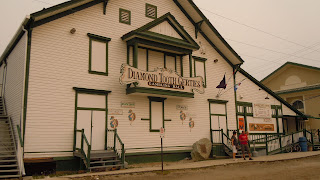
We settled in at the Gold Rush RV Campground in downtown Dawson City and relaxed until we got together for dinner. After dinner we decided to take in the live, cabaret-style show at Diamond Tooth Gerties, which was only a 2-block walk from the campground.


We slept in until 7AM on Wednesday and around 10AM went out to see the Dredge Number 4, a Canadian National Historic Site, on Klondike Creek. The tour took over an hour and it was very interesting. The wooden-hulled dredge was massive, 8 stories high, 140-feet long, and displaced over 3,000 tons. It produced over 50-pounds of gold every three days.


After lunch, we went to the Dawson City Museum, but a power outage cut our visit short. We walked two blocks to see novelist Jack London’s cabin. Jack London lived here during his time in Dawson City and wrote about the Klondike Gold Rush. 

 
We were surprised to see a red German tour bus again, as we saw one 4-years ago on our trip to Alaska, in this same campground.


Thursday, June 25th, we crossed the Yukon River on a free ferry from Dawson City to the beginning of the “Top of the World Highway”.  The ferry is provided by the Yukon government.
We plan to drive just over 108 miles to Chicken, Alaska, but it will take about 4-hours or more because of the road.

Steve & Julie Cornelius

Thursday, June 25, 2015

Whitehorse & Carmacks, Yukon Territory

We arrived in Whitehorse at the High Country RV Park around 1:30PM on Thursday, June 18th and got settled in to our site just before Vince & Lisa came back from having their 5th wheel repaired. The park was full and thankfully Vince & Lisa had made a reservation for us so we’d have a place to stay.

We went downtown Whitehorse with Vince & Lisa to visit the SS Klondike National Historic Site. The SS Klondike is a paddle-wheeler that was used to transport people and cargo up the Yukon River to and from Dawson City. It took about 40-hours to go downstream to Dawson City, but 4-days to come up the river, against the current, to Whitehorse.


On Friday, we went out for lunch and afterwards, toured the MacBride Museum. It was very good, many artifacts on gold-rush pioneers, as well as many other exhibits.


After seeing the museum, we went to the Yukon Brewery for the 4PM tour. The tour lasted about an hour and ended with sampling their eight different beers. We had drunk the Yukon Gold, an English Pale Ale, back in 2011 and really liked it. The Yukon Brewery is a small batch brewery and doesn’t export their beer to the USA. It’s the only brewery in the Yukon Territory.


Saturday we drove to Carcross, “formerly Caribou Crossing”, about a 40-minute drive from Whitehorse, on the road to Skagway, AK. It was an interesting small town with many First Nation (native Canadians) arts and crafts shops. We enjoyed lunch at the local bistro.


On Sunday, June 21st, we experienced the summer solstice with around 20-hours of daylight this far north. The sun wasn’t setting until around 11:30PM and sunrise was about 3:30AM. It never really got dark out, more like twilight between sunset and sunrise.
We left Whitehorse on Sunday about 7AM heading north up the Klondike Highway towards Dawson City. It was a 350-mile drive that takes about 8-hours.

About a half-hour and 20-miles out of Whitehorse, Vince & Lisa’s Ford F-350 truck experienced a mechanical problem. They lost power and pulled off to the side of the highway. They had a low fuel pressure alarm and it wouldn’t start. We stopped on the side of the road to help out. We took our pickup off and drove back towards Whitehorse where we had cell phone coverage to call for a tow truck. We ended up going back to the campground we were in for another night. Vince & Steve waited for seven long hours alongside the road for the tow truck to show up. They towed the 5th-wheel back to the campground and the truck to the local Ford dealer. It turned out that when the Ford technician replaced the fuel filters last Friday, he over-torqued the fuel filter O-ring gasket which caused air to get in the fuel line.
On Monday morning, June 22nd, the Ford dealer repaired the truck and we were on our way again by 11AM. We decided to overnight in Carmacks, about 120-miles up the Klondike Highway. On the way up we saw two bald eagles and a grizzly bear alongside the road. Carmacks is on the Yukon River and is a historical stop between Whitehorse and Dawson City. The old stagecoach line stopped there at a roadhouse where passengers stayed overnight and ate meals.


Just north of Carmacks, on the way to Dawson Creek, we passed by Five Fingers Rapids on the Yukon River.

Steve & Julie Cornelius

Friday, June 19, 2015

Dawson Creek, BC to Whitehorse, Yukon Territory

We had a nice drive to Fort Nelson, BC on Monday, June 15th.  On the Alaskan Highway, Fort Nelson is at the 300-mile marker. We stopped at Sasquatch Crossing for lunch with Vince & Lisa, where we had stopped 4-years ago.


It was a “three bear” day on the Alaskan Highway. First we saw a single bear alongside the road in the grass eating. A little farther up the road we saw two more bears. With no one behind us, we were able to stop and take some pictures. Vince & Lisa were driving about 20-minutes ahead of us and they also saw three black bears.


On Tuesday morning at the campground, Vince & Lisa discovered a problem on their RV and decided to head to Whitehorse where they had an appointment for repairs on Thursday morning. They were going to drive to Watson Lake and we were only going to drive to Muncho Lake, about 150-miles up the road, but we’ll meet them in Whitehorse.  

We didn’t see any bears, but did see five moose (a cow and baby moose, two moose crossing the road, and a bull moose that saw us coming up the road and ran into the woods). The moose were all too quick for us to get any pictures, but we did see three stone sheep.


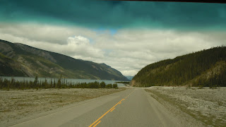
We decided to stay overnight in a BC Provincial Park campground on Muncho Lake. The Muncho Lake scenery was spectacular. The lake water is blue-green and reminded us of the Caribbean water colors. Julie spotted a moose around 9:30PM at the lake’s edge and got a photo of it.


Wednesday, June 17th, we left Muncho Lake and British Columbia and finally crossed over into the Yukon Territory on our way to Watson Lake, YT. We stopped in Coal Creek for lunch and met a couple who were with Adventurer Caravans on a trip. They were the “tail-gunners” at the back of their group of RVs. They were from Lincoln, NE and have been “full-timing” since 2000 and working for Adventurer Caravans since 2001. They’ve been on numerous trips throughout the U.S., Canada and Mexico.
We spotted several buffalo along the road today and a couple of swans on a lake, but only one bear. We stopped to take some photos of the bear and Julie was excited. I asked her: “Are you ready to go; it’s just another bear.” She didn’t think that was funny.


We got to Watson Lake, checked in at our campground, and detached the truck. We went into town and washed the truck. Then we went to the “Sign Post Forest” and spent about an hour looking at all the signs. The signs were from all over the U.S., Canada, and all over the world. They are mostly street signs and license plates and number over 80,000 total. The “Sign Post Forest” was started by a homesick G.I. during the building of the Alaska Highway in 1942.     


On Thursday, June 18th, we left the Watson Lake area and headed towards Whitehorse, about a 250-mile drive. Julie spotted a bull moose, on her side of the road, standing in a small lake eating vegetation from the lake bottom. She saw it as we were rounding a curve and we couldn’t stop soon enough to take a photo.
We crossed the long bridge over Teslin Lake and stopped for lunch.
 
 
Steve & Julie Cornelius